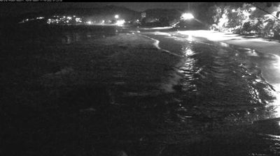
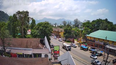
Mae Sariang: 108 Road Tattoo
![]() Mae Sariang, Thaïlande
Mae Sariang, Thaïlande
Real-Time Environment
Welcome to the live streaming webcam for Mae Sariang: 108 Road Tattoo, perfectly situated in the vibrant region of Mae Sariang, Thaïlande. Watching this live camera allows you to instantly experience the local atmosphere and monitor current climate conditions.

About Mae Sariang district
Mae Sariang is a small town and district (amphoe) on the narrow valley along Yuam River in Mae Hong Son province, northern Thailand, along the Myanmar border. The areas around Mae Sariang are mountainous and forested; flat terrain that suits population or agriculture is scarce. The local population of Mae Sariang is of mixed origin. The main ethnicity in the low land plain, town center and its satellite villages along the river is Tai Yuan with some cross-marriage with other ethnicities. There are also Tai Yai or Shan people in the town center; they are among the first groups that inhabited the area. Red Karen and Karen descendants also reside in the town with a high density in the Christian quarter of the town. There is a sizable Bengali Muslim community and a mosque near the central market. The area has many links to Burma, such as its architecture and a large population of Burmese Muslims. Mae Sariang represents the westernmost area where Lanna culture and architecture dominated which also well assimilated with Burmese/ Shan.
📖 Read more on Wikipedia📍 Location Facts
-
Country
 Thaïlande
- Region Mae Hong Son Province
- City Mae Sariang
- Coordinates 18.2103°N, 97.9380°E
Have you been to Mae Sariang?
Help the community! Share your experience, tell us about the weather, or upload your own photos from this exact location.